Fire Mountain Scout Camp has intention on building more buildings for activity and housing purposes. This GIS will offer an excellent example of prudent planning by using the data we have collected to perform a site analysis.
Building Site analysis will require consideration of camp soil properties, stream buffers, wetland buffers, and slope. Although there may be more considerations, this will give an overview of where the camp might consider construction additional buildings.
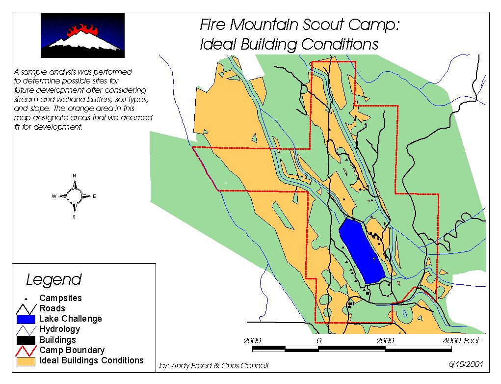
Here's what was wrote about the analysis:
6/5/01
Andy Freed
To provide a sample of the analysis that this GIS can be used for, I did a study to determine possible locations for building sites by looking at a number of different themes and attribute properties. I looked at Soils and their classification for buildings according to the USDA Soil Survey. I converted that to a grid using the moderate values as 1s and severe values as 0s. I multiplied this grid with the Slope Grid to find areas that were under 10% slope and were classified as moderate building sites. Then I clipped this theme to match stream buffers that were designated by the Forest Stewardship plan. These buffers were 200’ for type 1 & 2 streams, 100’ for type 3 streams, and 50’ for type 5-9 streams. Then I created a polygon from this theme, and used X tools to erase the stream buffer from the building site polygon. After this, I erased the wetlands and a 100’ buffer from the site theme. This provided me with a polygon that shows possible sites that meet the forest stewardship plan’s restrictions for stream and wetland buffers, and it situated on a slope of 10% or less, and is on soils that are classified by the USDA as moderately buildable. This theme will provide a quick reference for locations that might be ideal for a future building.
Tools used.
Geoprocessing Wizard
Xtools.