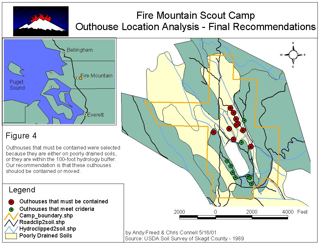
This analysis is to determine which outhouses (kybos) need to be contained due to the drainage of the soils or proximity to hydrologic features.
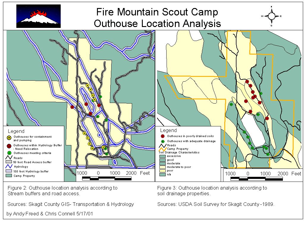
To start with, we analyzed outhouse locations in relation to the 100 feet stream buffers to determine those needing relocation outside of the buffer. We found four outhouses that need relocation, identified on the map. We also analyzed locations of outhouses within 50 feet of access roads, making them suitable for containment and pumping. Unaffected outhouses can remain in place.
In Figure 3, we analyzed locations of outhouses with drainage characteristics of soils. We looked to see which outhouses in their current location meet soil drainage criteria. All outhouses located on soils with adequate drainage are symbolized as green circles. All outhouses identified by the color red are located on soils with inadequate drainage and should be contained or moved.

